There is such a thing as too much Internet. When my friend Don Campbell suggested a backpacking trip to Labrador, the first thing I did was Google the destination - Torngat Mountains National Park. It didn't take long before I found two stories that stood out - "Tragedy in the Torngats" and "Polar Bear Man".
"Tragedy in the Torngats" refers to a climbing trip by a young Canadian couple that ended in their tragic death in a blinding snowstorm...in August. "Polar Bear Man" is the nickname given to an American lawyer who visited the park in 2013 on a Sierra Club expedition. He was dragged out of his tent in the middle of the night and had his throat torn out by a polar bear. He lived.
"the fleeing polar bear had something in its mouth as it ran off into the night—it was one of their travel companions. Matthew Dyer. He was no longer screaming"
These were not exactly confidence inspiring tales. Yet Don assured me we would be safe.
"We'll have a bear fence"
"Our trip leader is an Army guy. He's going to have a gun."
The gun part re-assured me somewhat. Althought further research revealed that an adult polar bear can reach 1000 kg, about the weight of a compact car. I suspect being shot by a gun would only serve to anger a beast like that.
Despite my reservations, I committed to the trip and plunked down my reservation money. After all, it was the 100th anniversary of the National Park system and what better way to celebrate it than visit a 9,700 sq. km park that receives an average of 400 visitors a year.
Our plan was to hike to the base of Mt. Caubvick, the highest mountain east of the Rockies and, if we were up to it, try to scale it.
By the way, I did not share my Google search results with my wife.
Planning and Preparation
Planning for the July trip started in earnest in November. The most pressing issue was getting my ass into shape. I was carrying 185 lbs on a 5'10" frame. Not terribly out of shape but my worry was that we were going to have carry everything for 10 days. We estimated our pack weight at 60-70 lbs and we would have to walk an average of 15 kms a day, on rough terrain.
My previous wilderness backpacking experience was negligble. I've done a lot of day hiking and a couple of overnight canoe trips but nothing more remote than 100 kms from a major highway.
I had a lot of work to do and the best way to start was by fitting my training into my daily routine. Instead of driving my car to the commuter station, I walked. Instead of driving to the grocery store, I walked. If I was going to a Blue Jays or dinner downtown, I walked. You wouldn't believe the looks you get when you walk into a fancy restaurant wearing a giant backpack.
Then I started adding a load. I started carrying dumbells wrapped in towels in my pack but found them lumpy and the weight was never evenly distributed. Then I stumbled onto a brilliant solution while grocery shopping - bags of rice. They are stable, shape conforming and best of all - edible. They even come conveniently labelled by weight. I started with two 20 lb bags and then graduated to 60 lbs in the last month of training.
Food
This was a topic of considerable debate amoungst the expedition team. We knew there was no way we could carry enough food to sustain our normal caloric intake. Capen, our trip leader, thought we could get by on an average 1,500 calories a day, supplemented by arctic char that we could catch in the park. That was a bit alarming.
As Don put it, "I eat about 3000 calories a day and all I do is push a mouse."
We settled on 2,000 calories a day. We knew that there some days when we would expend 6,000 calories and our bodies would start eating themselves.
Shopping for food became an interesting exercise. Some of the guys went the easy way out and loaded up on freeze-dried food. I wanted to be a little more creative. Previously, I never paid attention to the nutrition labels on food packaging. Now I pored over them, paying special attention to weight and calories. I started a spreadsheet. By my calculation, the calorically densest food were Cliff bars and instant ramen noodles. Not surprising for Cliff bars but ramen? I always knew that instant ramen noodles are fried but judging by their whopping 39 calories per gram, they must be fried in whale blubber. The densest freeze dried meal I could find was Backpacker's Pantry Peanut and Raisin Oatmeal at a relatively paltry 13 calories per gram.
I ended up with 17 pounds of food for 10 days, including one liter of water. If you're interested in the gory details, check out my food spreadsheet which gives weights, calories and ratings (1 star = could barely choke it down to 5 stars = would definitely bring again). Note: I don't have anything against Cliff bars but by the end of the trip, they tasted like cardboard. In other words, I brought too many Cliff bars and not enough variety of snacks. To this day, I can't even look at a Cliff bar.
 Click for more detail
Gear
Here's a list of the gear and and clothing I packed. Total weight for gear, including pack was 27.8 pounds. Clothing weighed 9.4 pounds, 3.8 pounds worn and 5.6 pounds carried in my pack. There was really nothing I regreted bringing. At first glance, the fishing gear seems unnecessary but it paid off in spades on the trip. The Exped sleeping mat was comfortable but it was a pain to deflate and slowed me down every morning. It was also noisy. I think next time, I would opt for a simpler, roll-up mat. The (very expensive) Western Mountaineering sleeping bag was warm but I did not like the inside material. It stuck to my skin and did not feel comfortable. As for stuff I wish I had brought, I definitely would pack a book or Kindle and some playing cards. On a trip of that length, there were plenty of down times where I wished I had some form of entertainment.
At first glance, you might think it gross to have so little clothing for 10 days. But once you're in the wilderness, nobody cares how you look or smell and new sock day truly becomes something special.
Getting There
Getting to Torngat Mountains National Park wasn't easy. There are sea routes and air routes. We opted to fly in due to the fact that it was less likely to be affected by adverse weather.
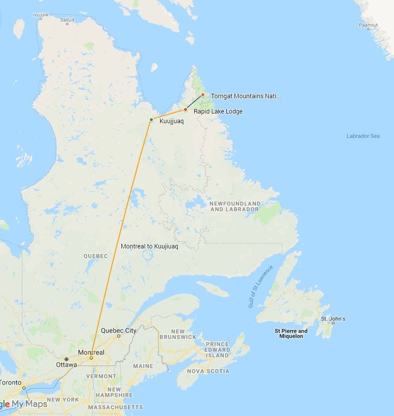 Our route to the park.
The first leg of the journey started in Montreal where the five expedition members met for the first time. There was the father and son duo of Gary and Capen. Gary was in his 50s and looked like an old ranch hand. Gary had years of experience in the backcountry. Fishing, hunting and generally being manly. He looked tough as nails.
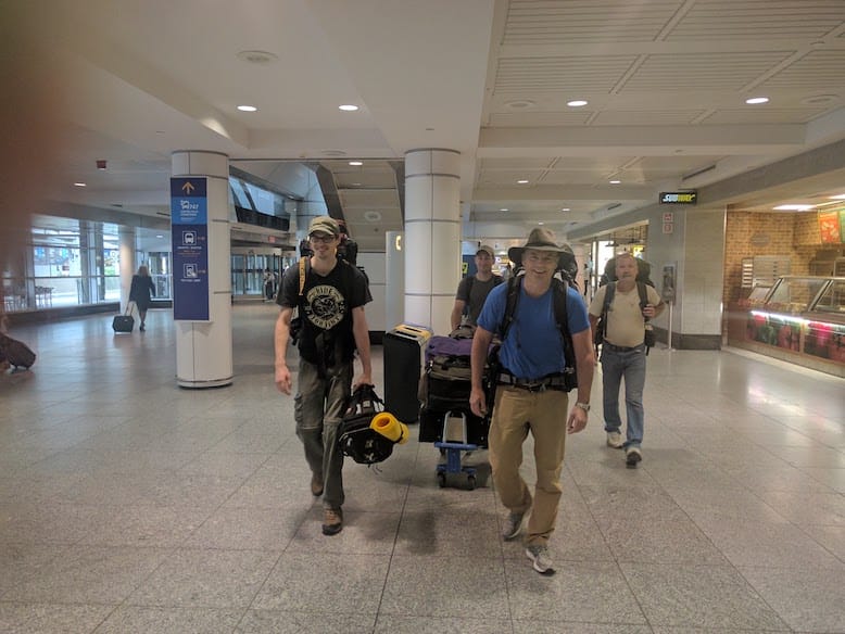 The expedition crew in the Montreal airport. Last chance for Subway
Capen was our de facto trip leader and a chip off the old block. Capen worked for the Department of Defence as a Search and Rescue Technician. He's the guy who gets winched down by helicopter to save your ass when stranded on a mountain top. Definitely a good guy to have around. But, he was most definitely unarmed. Apparently, there are no firearms allowed in Torngat unless you are a certified, Inuit bear guard. We found out that our defense against polar bears was limited to a flare gun. That's right, if attacked by a 1,500 pound carnivore, we were going to defend ourselves with firecrackers.
Next up was Gavin, a twenty something, beanpole geologist with a dry wit. Gavin spent time in Newfoundland where he and Capen did some climbing and backcountry hiking.
The soft spots in our group were definitely going to be me and Don, a couple of desk jockeys in our 50s. I took solace in the fact that Don had a bum knee which meant I could probably move faster. After all, you don't have to be faster than the bear, you just have to be faster than your buddy.
We flew out of Montreal on a First Air 737 to Kuujjuaq, Quebec, a village on Ungava Bay. Kuujjuaq is the traditional jumping off point for many northern adventures. The airport is small but modern. We even had a celebrity sighting. Shawn Majumder of "This Hour Has 22 Minutes" fame was there, embarking on a leg of the C3 Polar Expedition.
Majumder was very curious about our trip and asked me "Not to be racist or anything but are you the Sherpa?" Of course, I should have shot back with either a CBC or brown guy joke but couldn't think fast enough. I guess that's why Majumder is the comedian and I'm not.
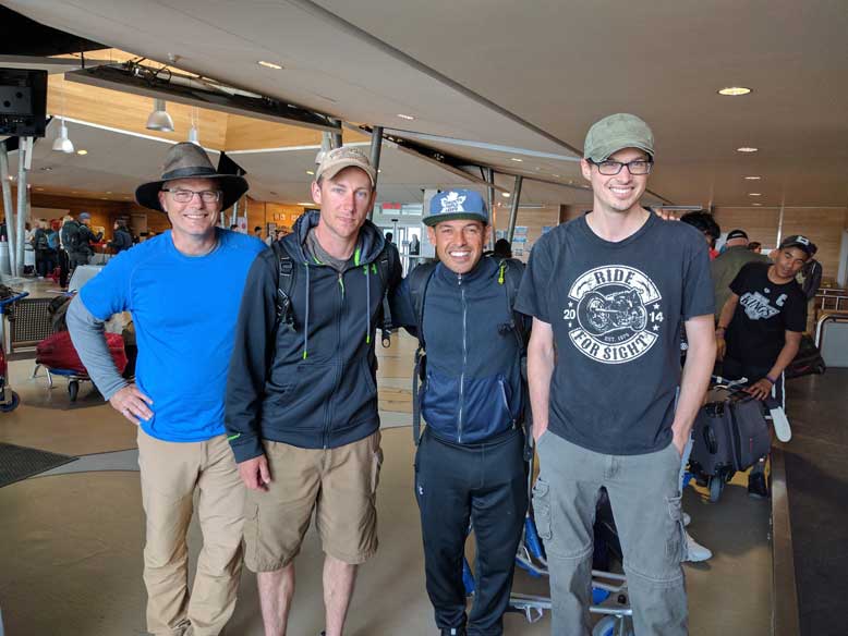 He looks taller on TV
From Kuujjuaq, we hopped on an Inuit Air Twin Otter, headed to Rapid Lake, a remote camp at the Labrador-Quebec border. Disconcertingly, we shared our flight with 4 drums of aviation fuel. The no smoking signs were unnecessary.
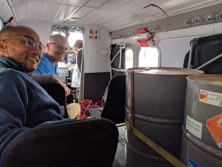 Don, me and some incendiary seat mates.
Rapid Lake Lodge was once a thriving fishing and hunting lodge. Sometime in the early 2000s, the caribou disappeared and the local Inuit tribes began to assert their sovereignty. Fishing and hunting ended. Rapid Lake was more or less a gas station now. Float planes travelling to Lands End at the northern tip of Labrador stop at Rapid Lake, fuel up and move on.
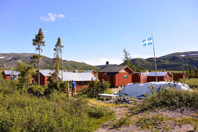 Rapid Lake Lodge
At Rapid Lake Lodge, we received our mandatory bear safety briefing. Alain, the camp operator, rented us a flare gun and a bear "fence" and assured us that they would be effective deterrents. I was skeptical. The bear fence was just an electrified string powered by two "D" cell batteries. We later found out that this exact fence was rented to the Sierra Club in 2013 and was useless in stopping the attack on "Polar Bear Man".
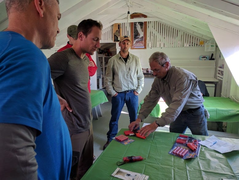 Alain explaining how a little pop-gun would scare off a polar bear. The look on our faces? That would be skepticism.
Also during the meeting, we discussed our plan to enter and exit the park. We had planned to land in the Tallek Arm and follow an established path called the Koroc/Palmer Route but Alain felt the Palmer River delta to be too risky. He called it part of the "Polar Bear Highway". Instead, we decided to land at the mouth of the McCormick River and make our way upstream through an unknown route and then west towards our eventual goal of Mt. Caubvick.
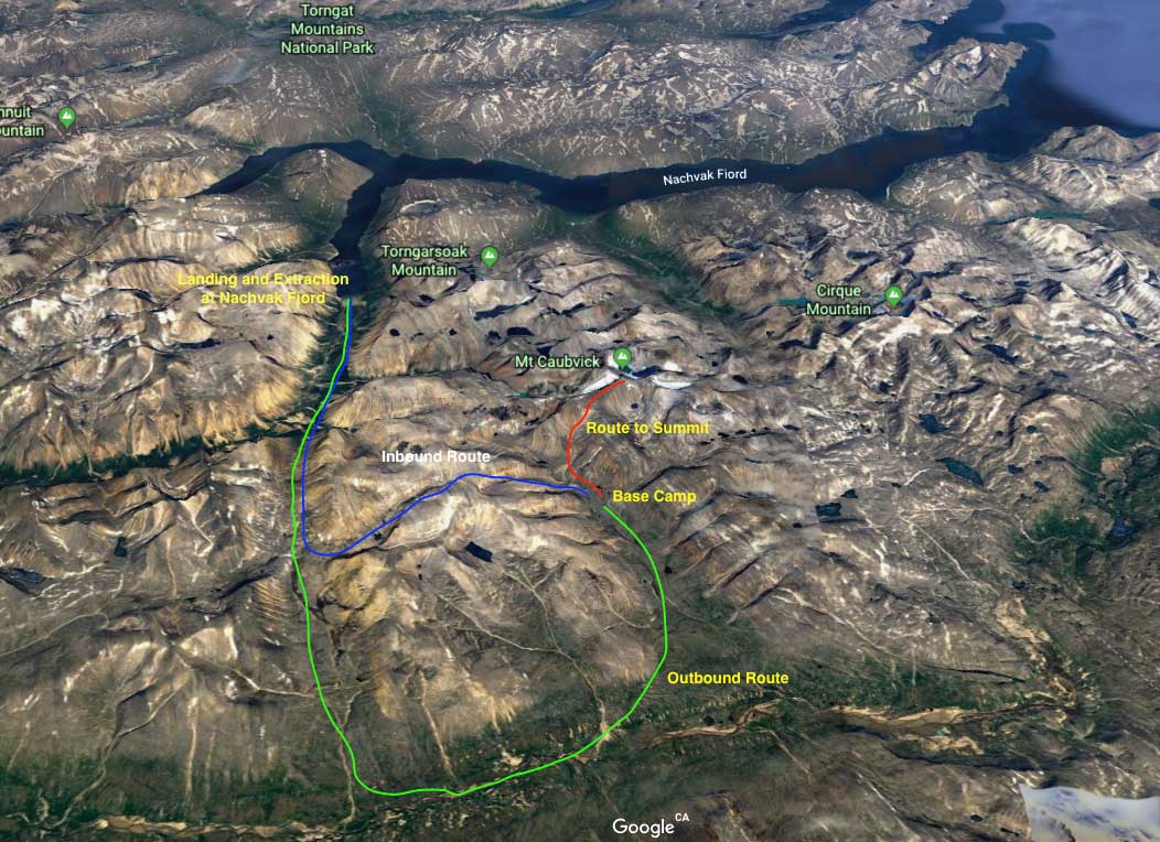 Our Routes in and out of the Park
Entering the Park
We were to fly into the park in a small Cessna float plane. After a 24 hour delay due to high winds, we flew in on July 25. The small size of the plane necessitated two trips for the team and all our gear. When Don and I landed on Nachvak Fjord on the second flight in, we were greeted by Capen holding up a healthy, 5 lb Arctic Char.
"How long did it take to catch that?", I asked.
"First cast.", answered Capen. It looked like we weren't going to starve after all. We fished for another 30 minutes and landed 10 to 15 more char. The char hit our spoons so aggressively that they were hooking themselves deep in their mouths. We eventually cut off all but one of the treble hooks and pinched down the barb on the remaining hook. We released all the fish except for three deep-hooked char that were injured and likely not to survive.
We knew we had get moving. To avoid polar bears, we were advised to get at least 10 kms away from the coast before making camp. Despite the urgency, we knew that this was going to be last fresh food we would see for days. We gutted the fish and lay them on a flat rock. We then built a fire around the rock.
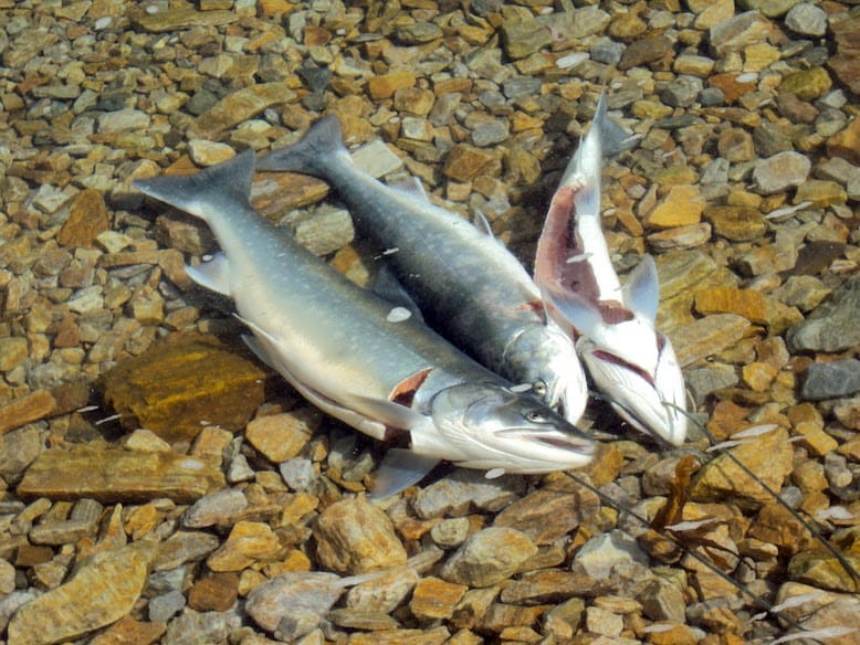 Breakfast. Photo credit Gavin Clow
Since we couldn't generate enough heat, most of the fish we ate turned out to be raw - and delicious. I'm a sashimi fan and this rivaled anything I'd eaten in Tokyo.
After eating our fill, we burned and buried the remains and started to walk inland.
"Where's the trail?", I asked.
"There isn't one.", Capen answered. Occasionally, we followed the faint remainder of a caribou trail but for the most part, we were breaking our own trail. This was especially tough in the river delta. A decade ago, it would have been easy walking on gravel banks. But climate change has made this area ideal for the growth of alder and willow in dense, inpenetrable patches. The waist-high alder grabs at your legs as you power through it. It was like walking through deep, heavy snow. The willow was worse. It grew to just above head height. It grabbed at everything - your limbs, your pack, anything attached to your pack. It was exhausting.
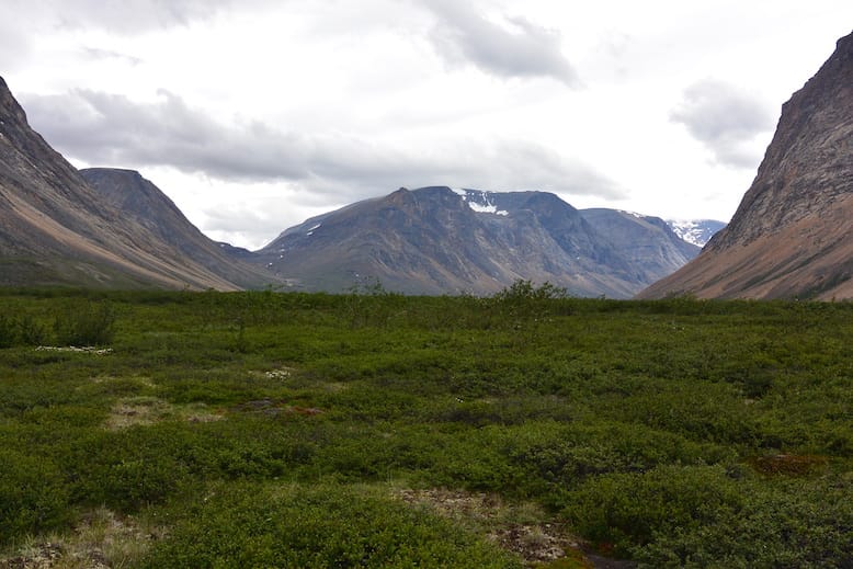 Dense alder and willow bushes at mouth of the McCormack River. Photo credit Gavin Clow
Moving On
It took about eight hours to move 10 kms to our first campsite. Finding water was never a problem. There were multiple streams running down the mountains into the river valley. The main challenge was finding a flat spot without a lot of rocks.
We quickly and almost wordlessly divided up our tasks. Don and I setting up tents. Gavin setting up the bear fence. Gary and Capen setting up a rock kitchen and gathering water and fire wood. I use the term "fire wood" loosely because there really wasn't any. It was more like "fire sticks" which we gathered and burned conservatively mainly for morale purposes. We did our cooking on Whisperlite backpacking stoves.
At about 500 metres of elevation, vegetation starts to disappear and you encounter the "rock zone". There are rocks of all shapes and sizes. Walking around all of them is impossible. You have to walk over them. And often, as soon as you step on one, it would roll. This was ankle busting country and our trekking poles were an absolute must. For everyone but Capen, who carried 15 extra pounds and bounded over the rocks like a billygoat, sans poles.
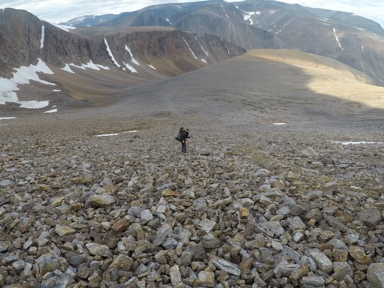 Rocks. Lots of rocks.
Often, Capen would leave us slowpokes and glide ahead so he could scout out the upcoming terrain. He was like the Sacagawea to our Lewis and Clark.
The second day of hiking was the hardest thing I've ever done. We walked 15kms over 13 hours - all of it over rough terrain. That's right, we averaged less than 1 kilometer per hour and it nearly killed me. Once we reached our destination, a flat valley below Mt. Caubvick, we all collapsed with exhaustion. Except for Capen, who immediately dropped his pack and took off to scout out the approach to the mountain.
The next day it rained. The entire day. This is where the Kindle or deck of cards would have come in handy. Without them, we stayed in camp, taking a well deserved rest day. When the blackflies got bad, which was pretty much all the time, we retreated into our tents.
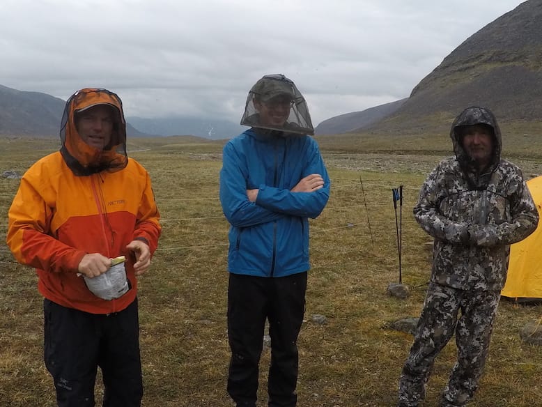 Blackflies are the perfect complement to freeze dried food. That's our bear "fence" in the background.
Climbing Mt. Caubvick
This was our day to tackle Mt Caubvick. At only 1,652 m, the mountain doesn't sound like much but it is the highest peak in Canada, east of the Rockies and it also features the only glacier in Eastern North America. It's only climbable five weeks a year and even in the middle of the summer can be subject to a blizzard.
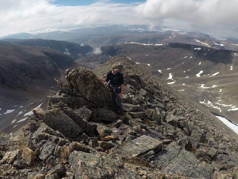 Climbing Mt. Caubvick.
That's what happened to the Susan Barnes and Daniel Pauze. Photos in their recovered camera proved that they reached the summit in a blinding snowstorm. Both succumbed to falls during their descent. The tragic events were told in a 2005 documentary.
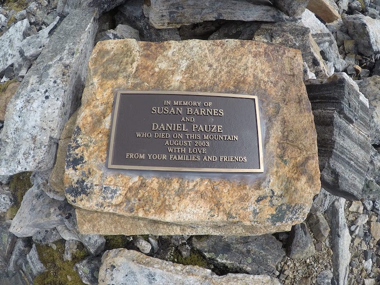 A memorial on Mt. Caubvick.
It's hard to do justice to the landscape and views of Mt. Caubvick. The view over the north side of the mountain with the glacier and blue glacial lake was breathtaking.
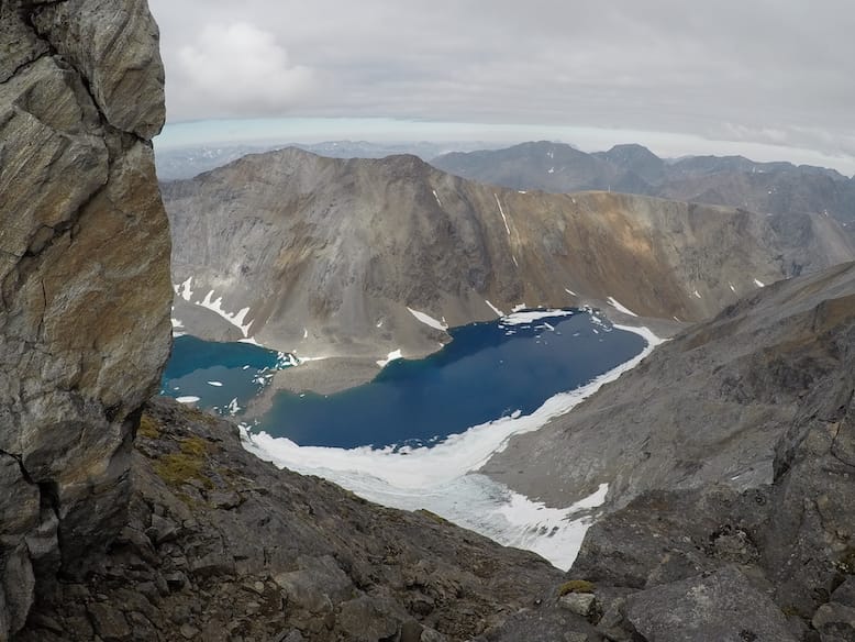 The only glacier east of the Rockies.
Unfortunately, we never made it to the summit. We simply ran out of time and turned back 100 metres from the top. It was heartbreaking, especially for Capen, but it was the right call. By the time we made it back to camp, it was pitch black. If we had lingered on the mountain any longer, it would have been very hazardous.
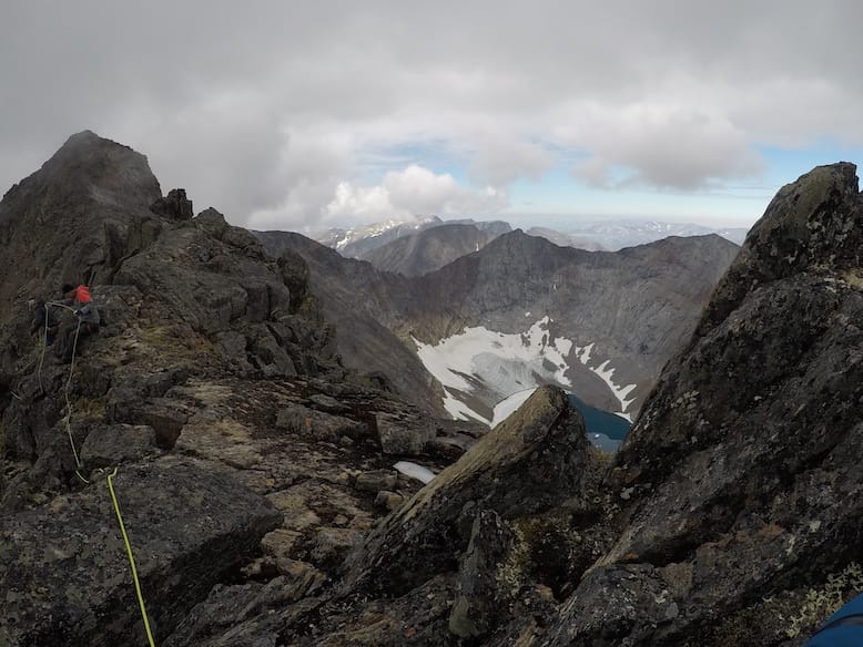 Tantalizingly close to the summit.
The Hike Out
The next day, we started our hike out of the park. This was two days earlier than we had planned but we made the call based on weather forecast. A front was coming in and if we delayed our departure, we might be stuck for a week or more. We relayed our plans back to Alain at Rapid Lake via satellite phone.
We followed a different route out, following the Koroc River downstream before doing a right hook towards the McCormick River valley. This took us through some stunning landscapes and was a much easier hike than the inbound route. The weather gods smiled on us during those two days and we were treated to sunny skies and temperatures in the high teens.
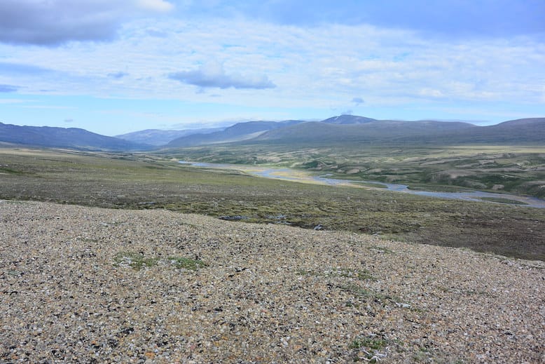 Beautiful day in the McCormick Valley.
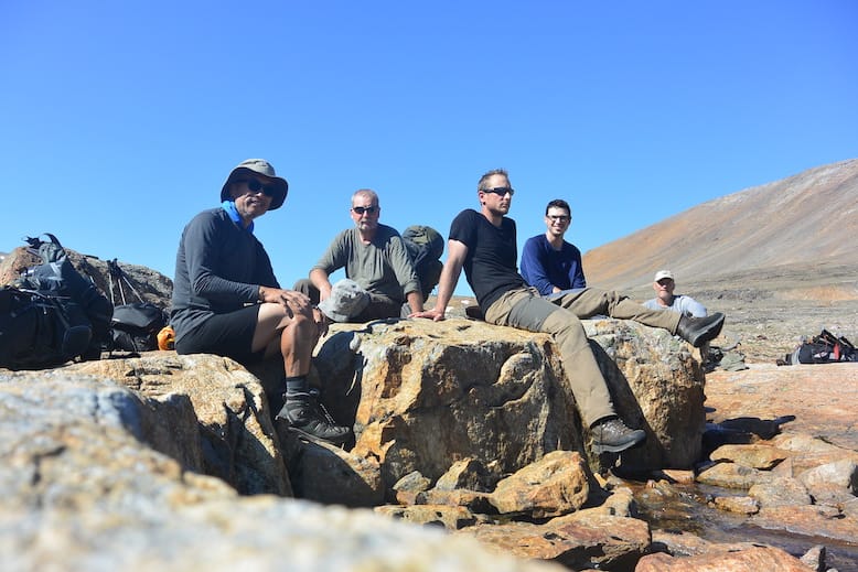 Rare shortsleeve day in the Torngats.
This was the day we had our single caribou siting - one lonely, solitary caribou. 20 years ago, the area would have been teeming with caribou. Their trails still criss-cross through the tundra but the animals are nowhere to be seen. Some blame climate change, others over-hunting and some claim that it's just a natural boom-bust of a prey species. Whatever the cause, it's sad to see and I'm sure the lack of caribou has caused great stress in the life cycles of the natives, both animal and human.
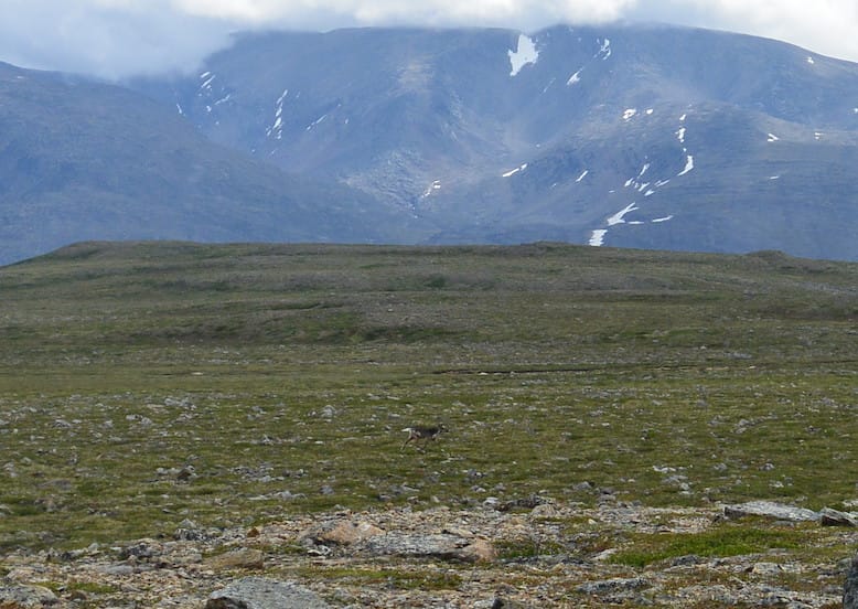 Can you see the caribou?
Home
After ten days in Labrador, it was strange being home in Toronto. The noise bothered me. Not just traffic and city noises but voices. For ten days, I only heard four other voices and we found ourselves using less and less words each day. The only other sound was running water, a distant rock fall and the screetch of a faraway eagle. In a a word, it was bliss. I never slept better or felt better in my life. It makes one wonder what sort of life we humans are meant to lead.
When I finally felt like talking again, my friends asked me if I would ever go back to Torngats. The answer is no. It was a once in a lifetime trip and I'd like to keep it that way. But I am glad I went and I'm sure it will remain one of the highlights of my life. Thanks Don for talking me into this trip.